Maps & Directions

Getting to Lake Tahoe Community College
From the West via Pioneer Trail
- Continue on Pioneer Trail until you reach Al Tahoe Blvd
- Turn left (north) on Al Tahoe Blvd and proceed approximately 1 mile
- College entrance will be on your left
From the West via Highway 50
- Continue on Highway 50 until you reach Al Tahoe Blvd
- Turn right (south) on Al Tahoe Blvd and proceed approximately .75 miles
- College entrance will be on your right
From the East via Highway 50
- Continue on Highway 50 until you reach Al Tahoe Blvd
- Turn left (south) on Al Tahoe Blvd and proceed approximately .75 miles
- College entrance will be on your right
Parking
- LTCC parking lots allow easy access to all campus buildings
- Parking permits are NOT required
- Parking is permitted in all lots in designated parking stalls
- Parking for people who are disabled is available and requires proper placards to be
displayed
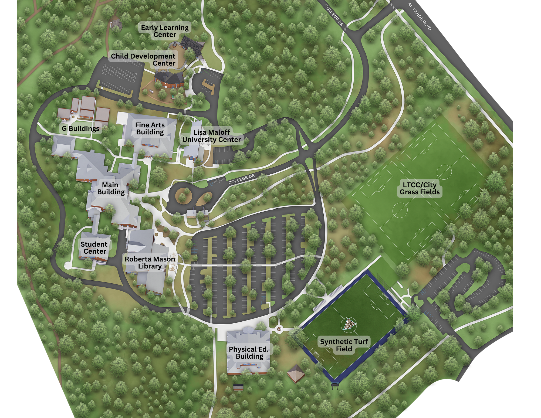
Campus Map

